If you’re the federal agency managing the nation’s highway system, it’s important to understand exactly which highways pass over federally owned lands.
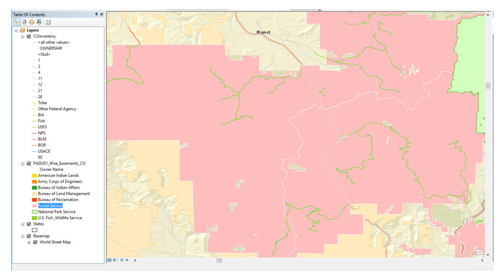
An early 2019 pilot project to do just that is being undertaken by the U.S. Department of Transportation (USDOT) Federal Highway Administration (FHWA) which is comparing PAD-US and federal highway data from the Highway Performance Monitoring System (HPMS) to explore alternatives that reduce data gaps in HPMS. The pilot was limited to federal areas with a goal to validate the highway ownership data available in HPMS with federal lands in the PAD-US 2.0 Fee feature class through a simple geospatial overlay.
A USDOT analyst presented the results of the Colorado-based pilot to the Federal Lands Roads Working Group and found federal highways in HPMS aligned well with federal lands from PAD-US. The group found the pilot informative and suggested another state comparison in Fall 2019 with updated HPMS data.
Impact of PAD-US use: The potential to save time and improve data quality IF federal fee owned parcels from PAD-US accurately predict federal road ownership in HPMS.
Illustration of GIS overlay analysis (section of Roosevelt National Forest):
