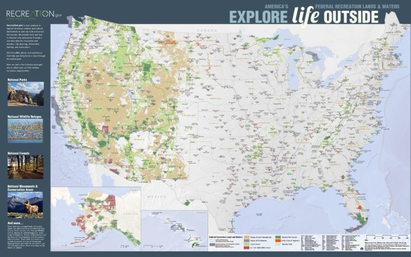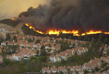
Fighting wildfires requires access to lots of geospatial information, which is used to plan and direct on the ground responses, determine responsibility areas (federal vs. state, etc.), track historical information for analysis, etc. PAD-US data is a crucial part of…
Read more